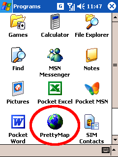
Download PrettyMap & PrettyEarth for Windows Mobile/Pocket PC
Ensure that you have read the license agreement before installing and using PrettyMap or PrettyEarth. By installing these applications you expressly consent to be bound by the terms and conditions of this agreement.
See PrettyMap and PrettyEarth comparison table.
 Downloads:
|
PrettyMap 6.0 for Windows Mobile |
PrettyEarth 6.0 for Windows Mobile |
Supported devices
PrettyMap supports Windows Mobile and Smartphone devices (touchscreen required) with Windows Mobile 5.x and Windows Mobile 6.x, and requires .NET compact framework version 2.0 installed. If you have problems running PrettyMap, download .NET compact framework version 2.0 or version 3.5.Revision history
While PrettyMap and PrettyEarth were in development, users who wanted to be notified about new versions could subscribe to the  news feed, and if they preferred email notifications, they could register on our forum and subscribe to Announcements.
 news feed, and if they preferred email notifications, they could register on our forum and subscribe to Announcements.
New in version 6.0:
- new option to adjust behavior on startup: don't open maps / restore recent session / open political map / elevation map
- non-ascii (language-specific) characters (like é, Ä, æ, ç, Ï, ß, etc.) are now supported in user maps
- user maps can be created and edited for other planets
- while selecting area in the "zoom area" mode, the red rectangle shows the actual area after zooming
- all settings windows redesigned and more responsive
- improved GPS support for older devices (Windows Mobile 4.x) and for some non-standard devices
- "Open Maps" window more responsive (opens and scrolls quickly)
- completely redesigned and reimplemented rendering: faster map drawing and panning
- faster zoom area/measure tools
- improved support for devices with screen resolution above 640px
- faster relief rendering
- numerous GUI improvements
- users who purchased version 5.x can upgrade to 6.x for $5
New in version 5.10:
- improved GPS support
- stability and performance improvements
New in version 5.9:
- faster startup
New in version 5.8:
- fixed compatibility issues with some devices
- a number of improvements in the user interface
New in version 5.7:
- improved GPS auto-detect feature
- when wardriving, PrettyMap scans for WiFi networks every one second
- when wardriving, a label is displayed
- added an option to skip loading databases in vector maps (useful for huge data sets)
- added "draft mode" vector map display
- added settings to adjust gradient colors
- fixed the "select color" window that would not open
- fixed opening duplicated maps if one had the same maps on device and on card
- a number of improvements in the user interface
New in version 5.6:
- map icons handle transparency properly (e.g. in the "Open maps" window)
- fixed problems with GPS on some devices
- "Autodetect" in menu:GPS changes to "Turn off" when GPS is active
- removed extra "success" message when GPS tracking
- a number of stability improvements
New in version 5.5:
- slightly faster displaying of vector maps
- fixed drawing of some vector maps: objects are now again sorted by importance (this was a bug since v5.3)
- improved default color styles for labels on vector area maps
- usability enhancements
New in version 5.4:
- new option, Auto-load maps (active by default), allows to automatically load raster maps (e.g. elevation or sat image tiles) most appropriate for the area you are viewing
- a message "...waiting for GPS fix..." appears when GPS is active, yet no coordinates have been received
- you can now use enter or space keys to zoom in, and backspace to zoom out
- shapefile-to-prettymap converter is much faster for shapefiles with many (e.g. more than 50,000) objects
- fixed a bug with exceeding top and bottom world boundaries while panning raster maps
- improved rules for colors of simple type labels on area maps
- slightly faster displaying of zoomed raster maps
- shapefile-to-prettymap converter can now convert encodings: from UTF-8 to Latin-1 (ISO 8859-1) and vice versa